
(Photos by J. Maus/BikePortland)
I hope everyone enjoyed our coverage from Southwest Portland last week. We’re not done yet! We’ve got two more posts we’d like to share: The first is a wrap up photo essay from my final two days of observations and explorations. Then we’ll recap the week and share what we learned from the smart people who showed up to our Get Together social event Friday night.
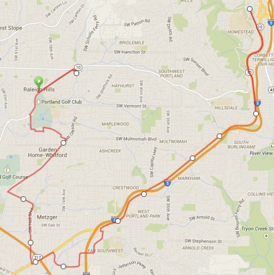
Let’s start with a bit more exploring. Here’s the route I did last Wednesday…
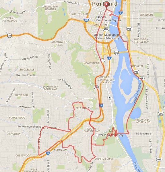
On Wednesday I decided to use the River View Cemetery approach. I headed south from downtown, connected to the Springwater Corridor path, crossed the Willamette on the Sellwood Bridge, then shifted into an easy gear and pedaled through the cemetery. After riding through Washington Park the day before, it dawned on me how crucial these off-highway routes are. Given the sad state of bike connections between southwest and the rest of Portland, that area of our city would be even more isolated without Washington Park and River View Cemetery.
Especially the cemetery. After all, unlike the park, it’s a private business that graciously allows bicycle access through their hallowed grounds. And it’s a very nice ride to boot, as long as you don’t mind the 1.6 mile, 377-foot climb.
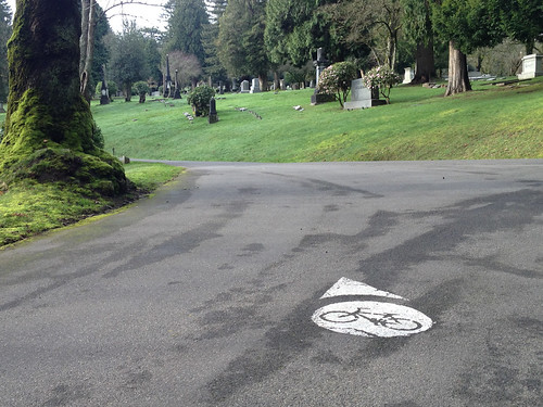
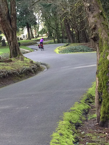
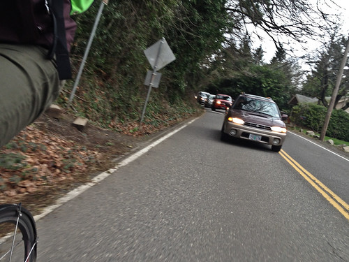
The end of the marked bicycle route (which you must follow in the cemetery) dropped me onto SW Palatine Hill Rd and from there I continued west and connected to SW Terwilliger. The bike lane on this section of Terwilliger is narrow and it doesn’t instill much confidence.
Speaking of confidence, you need quite a bit of it to merge left across Terwilliger at the I-5 freeway on-ramp…
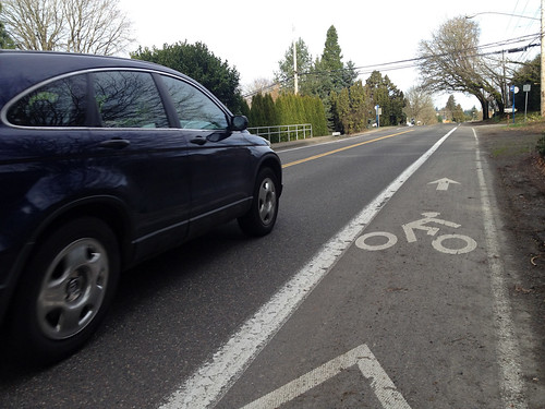
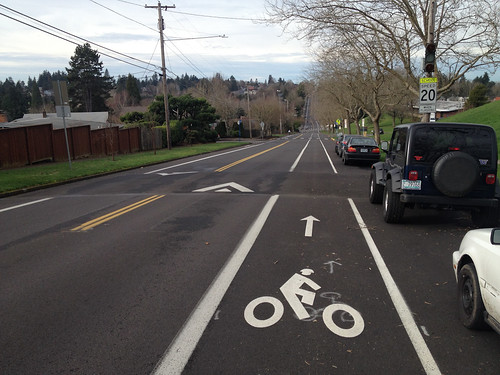
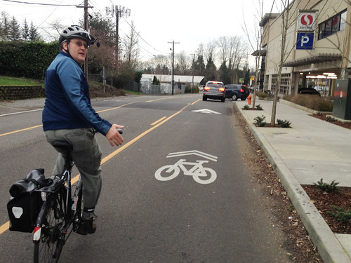
From Terwilliger I decided to check out some neighborhood streets, so I decided to try and reach the Hillsdale shopping center via SW Vermont Street. From a biking and walking perspective, Vermont is one of the most important streets in the entire southwest road network. It’s a straight, three-mile long east-west neighborhood collector that connects several schools, parks, and residential and commercial destinations. In southwest Portland, a straight neighborhood street that’s relatively flat is as precious as gold.
Because of that, Vermont has been the focus of attention from the City of Portland. PBOT has added speed humps, bike lanes, and sharrows to some parts of Vermont. Here’s how it looks at its eastern end outside Wilson High School and Rieke Elementary School…
Later in the day I met up with southwest Portland resident and uber-advocate Roger Averbeck. He gave me a guided tour of what he and many others feel is the highest priority active transportation project in the entire quadrant: A redesign on SW Capitol Highway between Multnomah/Garden Home and Barbur.
On our way to that future project site, Averbeck showed me SW Capitol Hill Road, what he calls a “classic southwest neighborhood collector.” It’s got speed humps, but there’s absolutely no shoulder (even though there’s plenty of unused right-of-way) and — with infill development on the rise — the auto traffic volume is ever-increasing.
At the southern end of Capitol Hill Rd (where it meets up with Barbur), Averbeck showed me how the street was impacted by a new Safeway development.
Averbeck and other activists pushed Safeway to build a sidewalk, but they said it would be too expensive. Fortunately they compromised and installed what he refers to as a “widened shoulder.” It’s not a full-fledged sidewalk, but it’s much better than nothing.
Then, as we approached Safeway, Averbeck somewhat disgustedly pointed out that the grocery giant declined his request for a bike lane to access the store and instead merely laid down a few sharrows.

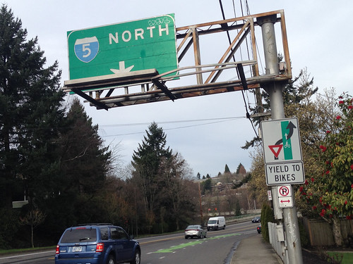
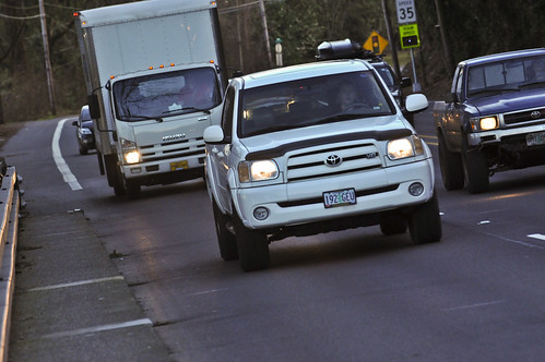
After I parted ways with Roger, I headed north on Barbur Blvd. I don’t usually venture this far down Barbur, so it was a good reminder to see and feel just how auto-centric and stressful it is to bike on.
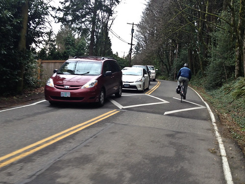
I wanted to get east over to Terwilliger, and using my trusted PBOT bicycle map, I turned off Barbur at SW 26th and followed some of their recommended routes: Taylors Ferry Rd to 18th Place to Maplecrest to 12th. As is usually the case in southwest, taking side roads meant lots of curves and hills. The bad news with these type of roads and topography is that it adds time, distance, and lactic acid to your ride. But the good news is that it’s quite beautiful.
Just a few minutes away from the roar of Barbur Blvd, I was riding next to the roar of Tryon Creek through the lush green trees of Marshall Park.
This little cut-through popped me out on Terwilliger just a few blocks south of Palatine Hill Road where my loop began.
On my final day of explorations in southwest Portland I decided to trace the rim of the Portland city limits.
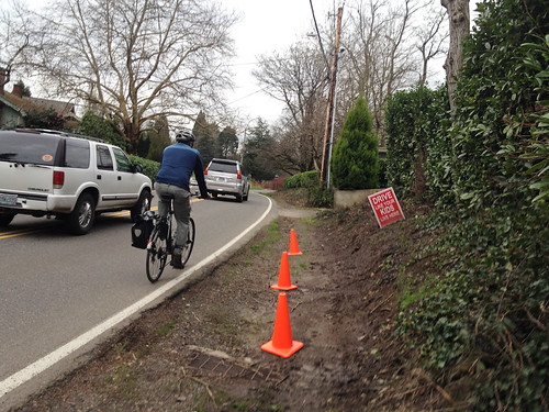
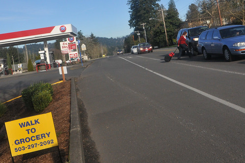
After waking up early to join Ali Reis for her daily commute, I rode into Raleigh Hills. From there I headed south on SW Scholls Ferry Road and (once again) used the Fanno Creek Trail to connect to SW Oleson Road. Both Scholls and Oleson have bike lanes, but they are standard width and you’re sharing the road with people driving 35-45 miles per hour. It’s not terrible for someone like myself, but it’s not exactly pleasant either. As for walking, that’s another story…
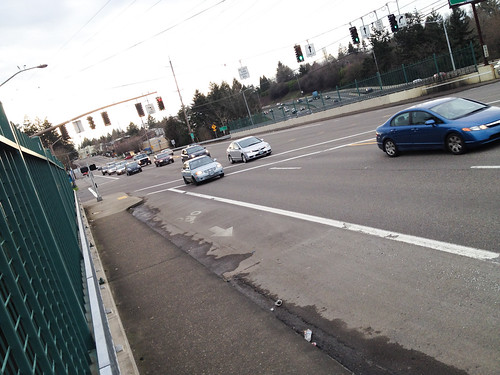
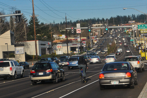
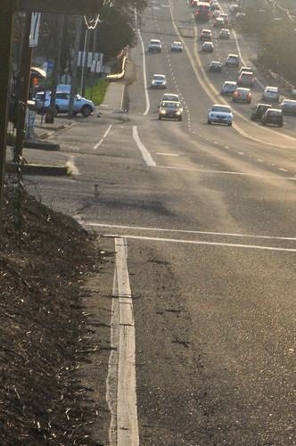
At the southernmost point of my entire week, I rode in the bike lanes on SW Hall Blvd to Barbur Blvd. This was a Barbur I had never known prior to last week. I think I was actually in Tigard at this point. Looking north at the intersection of Barbur and 76th, I got a great view of the roadway cross-section…
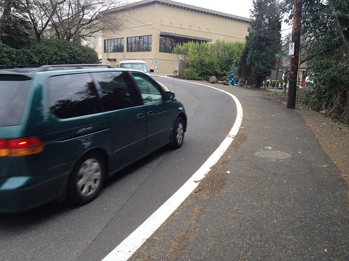
I did a little sidetrip onto SW Dartmouth through a big-box shopping center (was looking for new location of Western Bikeworks store but couldn’t find it). I wanted to get back onto SW Barbur but it wasn’t as easy as I hoped. I found myself on steep curvy roads with little to no room for a bicycle rider and an auto user to coexist. At one point on a narrow road I looked down and saw a massive open drainage culvert off my right shoulder while people revved their engines while driving past me on the left. In some ways I was relieved when I re-connected to the bike lane on Barbur.
But then this happened. I was happily pedaling in the bike lane when, at the intersection with SW 24th, it just completely dropped me. Here’s what I saw at the red light…
Then I pulled over and looked back (south)…
How can we so wantonly eliminate a lane of travel dedicated to a certain type of road user and then provide no other place for them to go?! This is what we’re up against all over southwest Portland — and especially on Barbur. So infuriating.
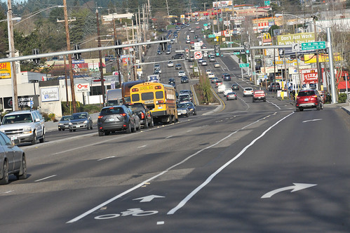
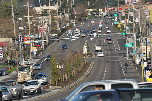
As I got further north and into more familiar stretches of Barbur, I decided to stop and do some observations. I finally got some good photos of the oft-talked about Vermont and Newbury Bridge pinch points in action.
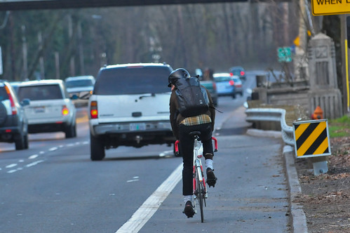
Would you want to share a lane here?
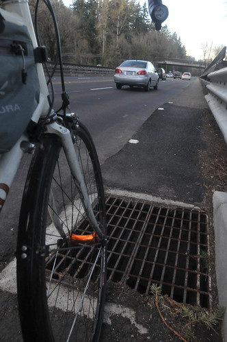
And since ODOT recently improved the sidewalks on the bridges, so they could potentially be used by folks who don’t have the confidence to take the lane, it was pretty sad to see this storm drain grate right at the bottom of the new ramp leading up to it…
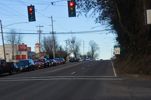
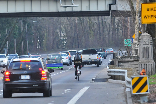
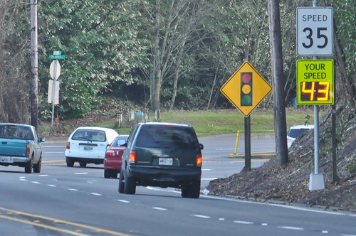
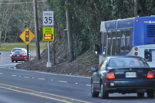
I also did the same thing Michael Andersen did when he was here earlier in the week. I photographed the rampant speeding that takes place all the time on this crucial bike connection (you can’t see it, but there’s a bike lane right underneath that speed reader board)…

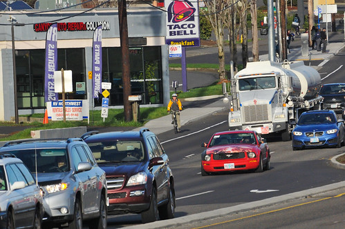
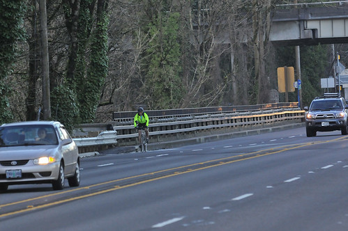
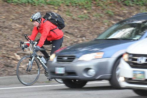
Speaking of this being an important bike connection, here’s what the bike riders look like on this stretch of Barbur…

Unfortunately, I bet some of those folks who have biked here for many years, have never felt like stopping and taking in the views. I don’t blame them, given that the human instinct tells us to flee danger as quickly as possible. But I was there to observe, so I pulled over and took in the view…
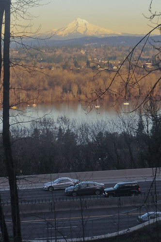
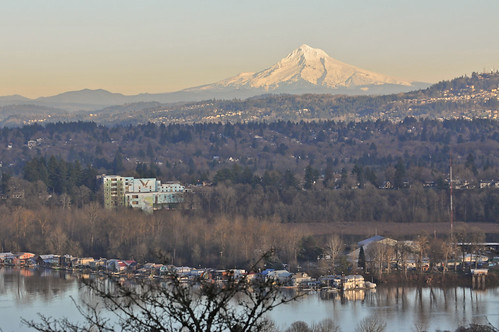
It was a reminder that this is still a beautiful place — we’ve just allowed it to become dominated by motor vehicle traffic at the expense of everything else.
— Stay tuned for our final wrap-up post that will summarize everything we’ve learned after our week in southwest Portland.

The post A final photo essay from our week in SW Portland appeared first on BikePortland.org.


